122-2033
Antarktis.
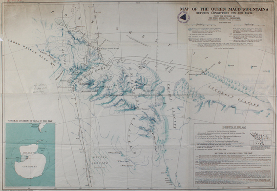
Map of the Queen Maud Mountains Between Longitudes 1750 and 1350 W. from the surveys of the Byrd Antarctic Expedition. Scale 1:500.000. Farb. Karte für die American Geographical Society, NY 1931. Blgr. 53,5 x 75 cm. Mit Insetkarte unt. li. "General location of Africa of the map" (ca. 17 x 13,5 cm) u. "Elements of the map" u. "Method of constructing the map" im unt. re. Eck. Mit Bibl.-St. u. hs. Eintrag im ob. li. Rd. Mehrf. gefalt.
Gedruckt auf Blandford Bold Papier. - Falze u. Ränder tls. eingerissen, ob etw. angestaubt, ob. re. Eck mit Randeinriss ca. 5 cm i.d. Titel.